Saturday, September 18th (Cottage Grove - Crater Lake; 109mi, 10680ft)
It was foggy and cool (in the 40s) when I left home and headed up over Garoutte Road. I followed the familiar route, turning right onto Shoreview Dr. at the bottom of the hill, then following Row River Rd. above Dorena Lake through Culp Creek. From there I headed up Sharps Creek Rd. At the end of the Sharps Creek Rd pavement I turned right onto Clark Creek Rd.
Although we were still having summery weather, there were signs of Autumn around. The red alder leaves were starting to turn brown, and a few were already dropping. Up around 2000ft elevation the vine maple leaves were red fringed.
Climbing up out of the fog on the steep Clark Creek grade I warmed up quickly. At around 10AM I reached the Calapooya Divide, elevation 3600ft. Then came the quick descent down first East Pass Creek, then Canton Creek. A quick jog on Forest Road 38 got me to Hwy 138 shortly after 11AM. I headed east on 138 along the North Umpqua River, passing many near-empty campgrounds.
It was about 3PM when I took a short side trip over to Diamond Lake to find a place to refill my water bottles. I picked Hwy 138 back up on the south side of the lake, and rode the last three miles to the Crater Lake Park entrance (elevation 5800ft). After shelling out five dollars at the kiosk, another ten miles and 1300 feet brought me up to the rim road. There I discovered that there was still more climbing to do! The rim road is anything but level.
I at last arrived at the lodge, and was checked in and in my room just ten hours after leaving home.
Sunday, September 19th (Crater Lake; 42mi, 4440ft)
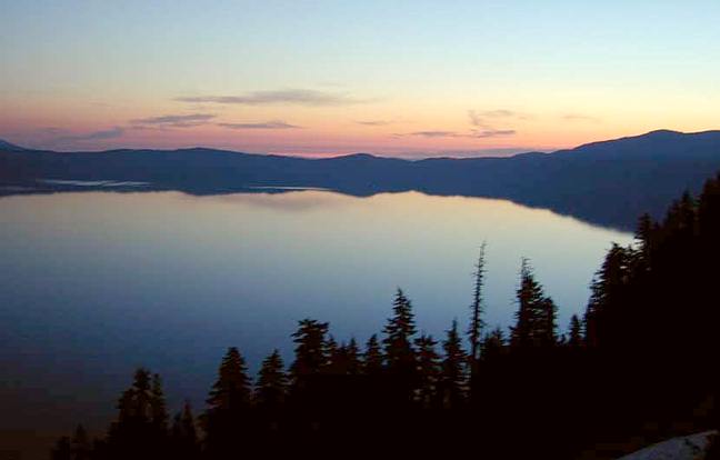
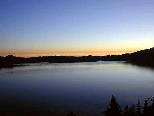
There was plenty of time before the restaurant opened for breakfast to watch the dawn break over the lake. After eating an ample breakfast consisting of two large blueberry pancakes soaked in Marionberry syrup, a garden omelet, potatoes and toast, I went out to take a few more pictures. Here's one of Wizard Island.
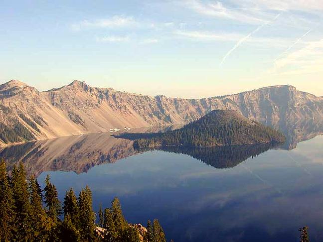
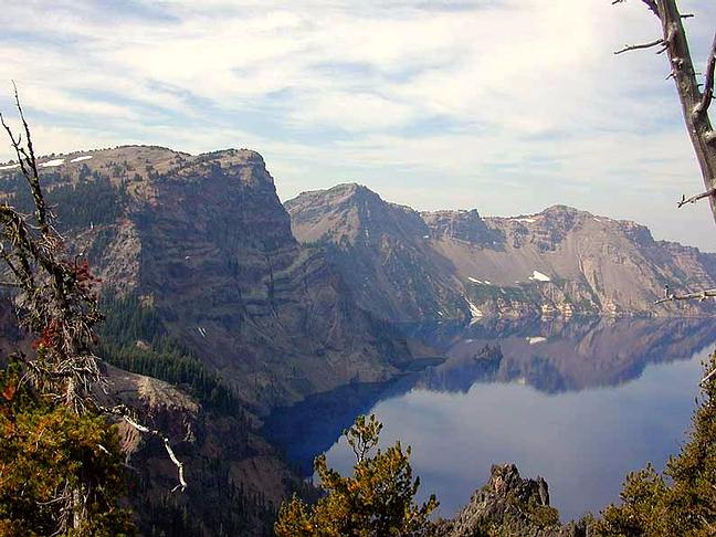
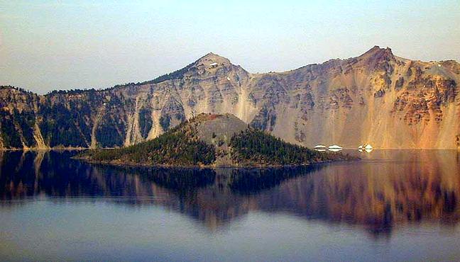
By 8AM the temperature was already up to 60F, so I got on my bike and headed down to Mazama Village to pick up some snacks for lunch. I then headed back up the hill, turning right on the rim road to circle the lake counterclockwise. Partway around the lake I took this picture of the Phantom Ship. The lodge is just off the right side of the picture. Sun Notch is the valley just left of center. A bit further I took this one of Wizard Island with The Watchman directly behind. Hillman Peak is to the right.
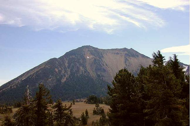
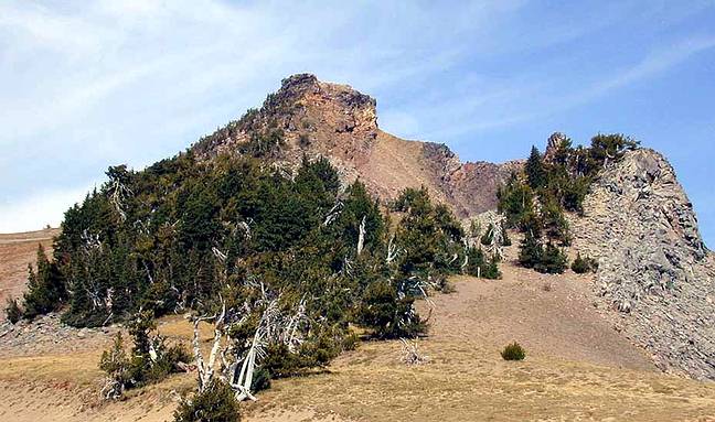
After taking the short side road to visit Cloudcap Overlook, I stopped at a picnic area to have some lunch. To the southeast looms Mount Scott, highest point in the park (8929ft). Almost back to the lodge I took this one of some twisted trees, pretty typical of the area. The heavy snow causes quite a bit of damage. All around the lodge are trees with their tops broken off.
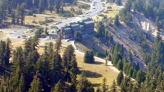
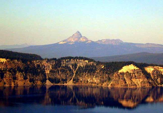
After my loop around the lake, I hiked part way up Garfield Peak. Here's a view of the Crater Lake Lodge from part way up. Note how it's built right on the edge of the rim. And here's one of Mt Thielsen to the north from even further up. The last half mile of the trail is closed this year, due to a persistent snow bank.
Monday, September 20th (Crater Lake - Cottage Grove; 108mi, 4230ft)
I again watched dawn break over the lake. The restaurant doesn't open for breakfast until 7AM. I was checked out and on the road shortly after eight. The trip home was pretty much the reverse of the trip there. But what was uphill one way, was downhill the other! Comming down off the rim I coasted at 40MPH for several miles. Sections of 138 are fast in that direction too.
In three days I rode 260 miles, climbed 19,350 feet, with no flats and no mechanical problems.
Last modified: September 15, 2001
Wayne Deeter - wrd@deetour.net